Güneybatı Finlandiya
Güneybatı Finlandiya (Fince: Varsinais-Suomi; İsveççe: Egentliga Finland), Finlandiya'nın bölgelerinden biridir. Bölge, Finlandiya'nın güneybatısında yer almakta olup Satakunta, Pirkanmaa, Kanta-Häme ve Uusimaa bölgeleri ile komşudur. Yüzölçümü 10,910.30 km² olan[1] bölgenin nüfusu 30 Eylül 2017 tarihi itibari ile 477,338'dir.[2] Bölgenin merkezi Turku'dur.
| Güneybatı Finlandiya Varsinais-Suomi Egentliga Finland | |
|---|---|
|
Güneybatı Finlandiya bölgesi | |
 | |
 Arma | |
| Ülke |
|
| İdare | |
| • Bölge başkanı | Kari Häkämies |
| Yüzölçümü | |
| • Toplam | 10.910,30 km² (421.240 mil²) |
| Nüfus (2017) | |
| • Toplam | 477.338 |
| Zaman dilimi | UTC+02.00 (DAZD) |
| • Yaz (YSU) | UTC+03.00 (DAYZD) |
| ISO 3166 kodu | FI-19 |
|
Resmî site www.varsinais-suomi.fi | |
Belediyeler
Güneybatı Finlandiya, 11'i şehir olmak üzere 27 belediyeye ayrılmaktadır.
Åboland-Turunmaa altbölgesi:
Salo altbölgesi:
Turku altbölgesi:
Loimaa altbölgesi:
Vakka-Suomi altbölgesi:
Galeri
 Turku Cathedral dating back to the 13th century is Finland's national shrine and one of Finland's most recognized buildings
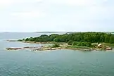 A typical view from Turku Archipelago, the largest archipelago (by number of islands) in the world
 Louhisaari Manor in Masku was the birthplace of Finland's marshal and president Mannerheim
 The Old Castle of Lieto and rural landscape
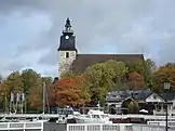 Naantali Harbour with the former Bridgettine monastery church in the background
 A general view of the City of Turku from the tower of the cathedral
 Bengtskär Lighthouse in Kimitoön is the highest one in the Nordic countries
.JPG.webp) Nautelankoski Rapids in River Aura in Lieto
Nautelankoski Rapids in River Aura in Lieto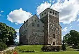 The medieval Turku Castle on the banks of River Aura is one of the most influential buildings in Finnish history
 Moomin World, Naantali
 A limestone quarry in Pargas
 Historical salt warehouses in Uusikaupunki town centre
 A bridge from 1850 in Taivassalo
 Korpo Church; there are 25 remaining medieval churches in the region
 Luostarinmäki Handicrafts Museum is an 18th-century district of the city that survived the Great Fire of Turku which burnt down four-fifths of the city in 1827
 May Day celebrations in Turku centre; the Arts Museum on the top of Street Aurakatu
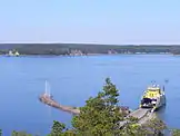 Traffic connections between islands are mostly served with ferries in the archipelago
 The National Romantic style Karuna Church
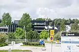 The mobile phone manufacturer Microsoft had originally its factory and headquarters in Salo; state-of-the-art models are still manufactured there
 A street view in Turku; old wooden houses and modern block of flats
 Marshland in Loimaa
 Naantali Old Town has been well preserved
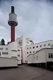 The functionalistic Paimio Sanatorium by Alvar Aalto
 A silo in Salo; the region still has a strong agricultural feel
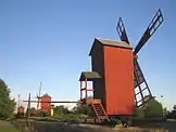 Windmills in Uusikaupunki
 The popular ferries travel twice a day around the year from Turku to Stockholm, Sweden
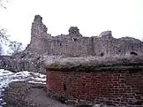 Ruins of the medieval Kuusisto Bishops' Castle demolished in 1528 during the Protestant Reformation in Kaarina
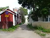 Pargas Old Town
 River Paimionjoki and rural landscape in Marttila
 Teijo Church in Salo is the smallest stone church in Finland
Kaynakça
- "Suomen pinta-ala kunnittain 2017-01-01" (Fince). Maanmittauslaitos. 1 Ocak 2017. 4 Ekim 2017 tarihinde kaynağından arşivlendi. Erişim tarihi: 23 Kasım 2017.
- "Tilastokeskuksen PX-Web-tietokannat / Taulukko: Ennakkoväkiluku muuttujina sukupuoli, alue ja kuukausi" (Fince). Tilastokeskus. 30 Eylül 2017. Erişim tarihi: 23 Kasım 2017.
Dış bağlantılar
| Wikimedia Commons'ta Finland Proper ile ilgili ortam dosyaları bulunmaktadır. |
- Resmî site

Vikigezgin'de :en:Finland Proper ile ilgili gezi rehberi bulunmaktadır.
This article is issued from Wikipedia. The text is licensed under Creative Commons - Attribution - Sharealike. Additional terms may apply for the media files.
